Swings #3 : Hydrothermal sources, discovering deep-sea geysers
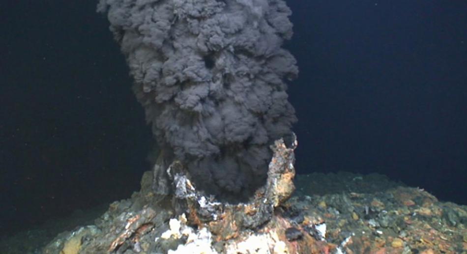
In the deep ocean, a spectacular phenomenon occurs: hydrothermal sources. Rich in nutrients and chemical elements, these geological formations, comparable to geysers, are essential to the life of deep ecosystems. Difficult to detect, several instruments are needed to locate and analyse them. SWINGS is equiped to explore the unknown depths.
By Victoria Lascaux, translated by Elena Masferrer.
The existence of hydrothermal sources was highlighted in the 1970s in the Pacific Ocean. Scientists discovered black "geysers" composed of numerous dissolved chemical elements and polymetallic particles. This was an exceptional discovery, but not it was understood at that time. Now, thanks to technological and scientific progress and numerous oceanographic missions, the data now indicates about one source every 100 km and their formation is better understood. They develop due to the infiltration of seawater into the rock of the seabed with which it interacts.
Indeed, the seabed is formed by an oceanic crust. This crust is similar to a sort of mountain range and it’s described thanks to the marine topography. The relief is very rugged, with very deep places - the deepest point in the sea is the Marianas Trench (Pacific Ocean), which reaches 11,000 metres. As soon as water infiltrates and percolates along the faults in the oceanic crust, it warms, changes and becomes enriched with chemical elements on contact with the deep magma chamber before emerging into the ocean in the form of geysers. These hydrothermal sources are very hot fluids between 250° C and 400° C.
Another mechanism favours the formation of hydrothermal sources when this time the seabed is in the form of an "abyssal plain". In this case, seawater percolates through the marine sediments covering the oceanic crust. Below the surface, this process also leads to the formation of low temperature hydrothermal sources of less than 20°C at greater or lesser depths.
The SWINGS scientific team is heading for the unknown, both in terms of the type of hydrothermal sources that will be present on their trajectory: very high temperature, or moderate temperature? ... and in terms of the detection of the sources themselves. Surprise!
The temperature is rising... a chance for the ecosystems
Other than their surprising formation, hydrothermal sources contribute to the development of deep ecosystems (crabs, mussels, microorganisms...) living in the darkness of the Deep ocean. These "geysers" contribute to extracting internal heat from the oceanic crust. As soon as the seawater heats up thanks to the magma, the geyser interacts with the rock. The chemical elements that make up the rock are then extracted from it and conversely, certain elements present in the water are stocked by the rock. This bilateral interaction allows the fluid to become enriched with metals and gases (carbon dioxide, methane, hydrogen, nitrogen, hydrogen sulphide). This fluid is up to a million times more enriched than seawater. All these elements are therefore a source of life for ecosystems that do not have access to light and therefore to photosynthesis. They have adapted their metabolism in order to use all the elements that are in reduced form, such as iron or sulphur, but like us, in order to live, they need carbon and oxygen. Their development is therefore different from that of organisms on the surface of the Earth.
Seeking out hydrothermal sources
For more than 50 years, scientists have been exploring these hydrothermal sources and understanding their activities better and better. However, there are still unknowns such as their preferred zones and their estimated lifespan of around a thousand to tens of thousands of years... amazing!
The scientific team of the SWINGS cruise believes that the area of the Southwest Indian Ridge, which has been little studied to date, could also present deep hydrothermal sources, whose presence will have to be detected. As soon as the axis of the Southwest Indian Ridge approaches, the first step is to carry out a bathymetric survey of the identified zone with a multibeam sounder. Before sampling and analysing all these elements, it is necessary to be able to locate these hydrothermal sources.
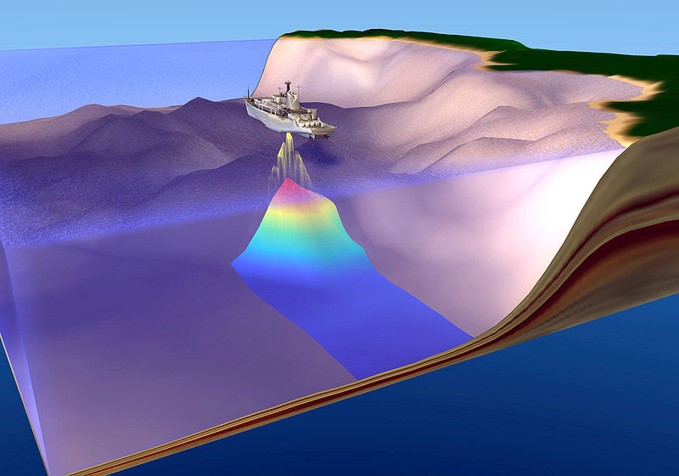
This instrument is on the vessel and not in the water, it "scans" the ocean at depth with acoustic waves in order to obtain a topographic map of the seabed but also to detect acoustic anomalies in the water column such as those generated by hydrothermal sources. After this first step, the CTD-rosette comes into play. It descends into the water column and gives live indications via a screen on the research vessel. It can detect anomalies in the water column affecting, for example, temperature or salinity.
The fluids ejected by a "geyser" are warmer and less salty than sea water, but extremely rich in chemical elements. It is also an area containing polymetallic particles which also creates one of the anomalies to be detected during analysis, that of turbidity. Other indicators being tracked down: radium-223, which can show high activity in the presence of hydrothermal sources. Finally, the scientific team is also looking at the oxidation of the water thanks to the oxidation-reduction sensors. High temperature fluids are very reduced, whereas sea water is very oxidised.
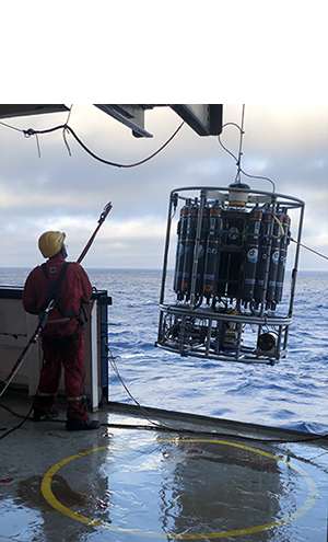
A final instrument is deployed: a rosette comprising 12L bottles that have been carefully cleaned to avoid any surface contamination during water sampling (See SWINGS #1 for more information). These bottles take water samples in which elements such as manganese and iron are sought. These complementary anomalies identify whether the vessel is sailing over hydrothermal sources.
All these steps are carried out on a daily basis by a few scientists on board and by the team that stayed on land. The research vessel’s trajectory and sampling protocols are continuously adjusted according to the data collected during the expedition. Monitoring the topography using the multibeam sounder requires watching the screen carefully for 25 hours without interruption, and writing the coordinates as soon as an anomaly is present. Scientists take turns for this particularly arduous task. Afterwards, all the other instruments mentioned above are deployed. This requires a real organisation and a complete availability on land and on board !
PORTRAIT
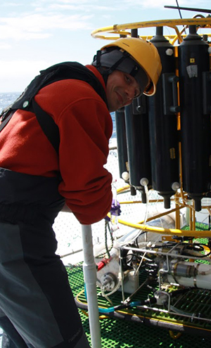
Cédric Boulart: the explorer with the feet on the ground
What is your role in this mission?
For this mission, I'm staying on land. From the Roscoff Biological Station, I am involved in the deployment of the instruments on board. I analyse the data from the sensors I receive, which allows me to guide the research. For example, based on the results, I can indicate on which sites sampling efforts should concentrate. With the support of Ifremer, we will also use an acoustic method to help us discover new hydrothermal sources.
What do you like about this adventure?
It's the exploration of zones that we hardly know. We ask ourselves a lot of questions, and these missions allow us to go and see what is happening in these unknown environments. I've already taken part in many other missions. I am particularly attracted to the scientific adventure side of things. There is always a part of the unknown and you never know in advance what you are going to discover.
What is your scientific background?
I began by studying marine chemistry at the University of Brest. Then I did my doctoral thesis at Southampton on the methane present in hydrothermal plumes. Then, after passing through Toulouse, Germany and Ifremer in Brest, I was recruited by the CNRS at the Roscoff biological station. There, I extended my research to methane anomalies in the ocean and in particular to their link with phytoplankton production.
What is your greatest scientific pride?
Having participated in missions during which new hydrothermal sites were discovered. For example, off the coast of Papua New Guinea, and on the Southeast Indian Ridge.
CRUISE DIARY
28 January : Since yesterday, scientists have been searching for hydrothermal sources. Several scientists are closely watching two screens. The first is for bathymetry, and the other is to look for "bubbles" in the water column, a sign of hydrothermal sources. The same work is also carried out on land, with scientists who have the same schedule. Coordination of information is essential.
Between screenshot, red eyes, false joy, time is beginning to be long. After 14 hours of intensive looking at the computer screen, no clear signs of hydrothermalism are evident.
A meeting with the captain is necessary. A decision is taken, in view of the unfavourable weather conditions, the station planned for the next day is now scheduled for today. The whole crew panics and prepares to deploy the standard, clean CTD-rosettes equipped with pumps! This station, which lasted 10 hours, is now called "stop-all". This work may have paid off, as particularly high radium-223 activity has been measured on the pump filter deployed near the bottom, which is a likely sign of hydrothermal activity. We will have to be patient and wait a few more months to see if this hydrothermal sign is found in other samples.
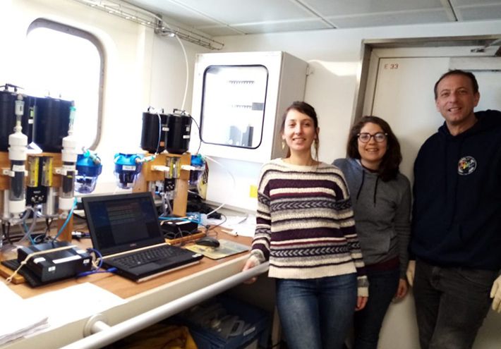
Next stop: the Marion and Prince Edward Islands! To be continued...
To learn more, follow the cruise diary : https://swings.geotraces.org

